Chapter 01 / Reservoir landscapes
The Making of High Water
A mountain reservoir is both a remarkable view and a record of decisions made across an entire valley.
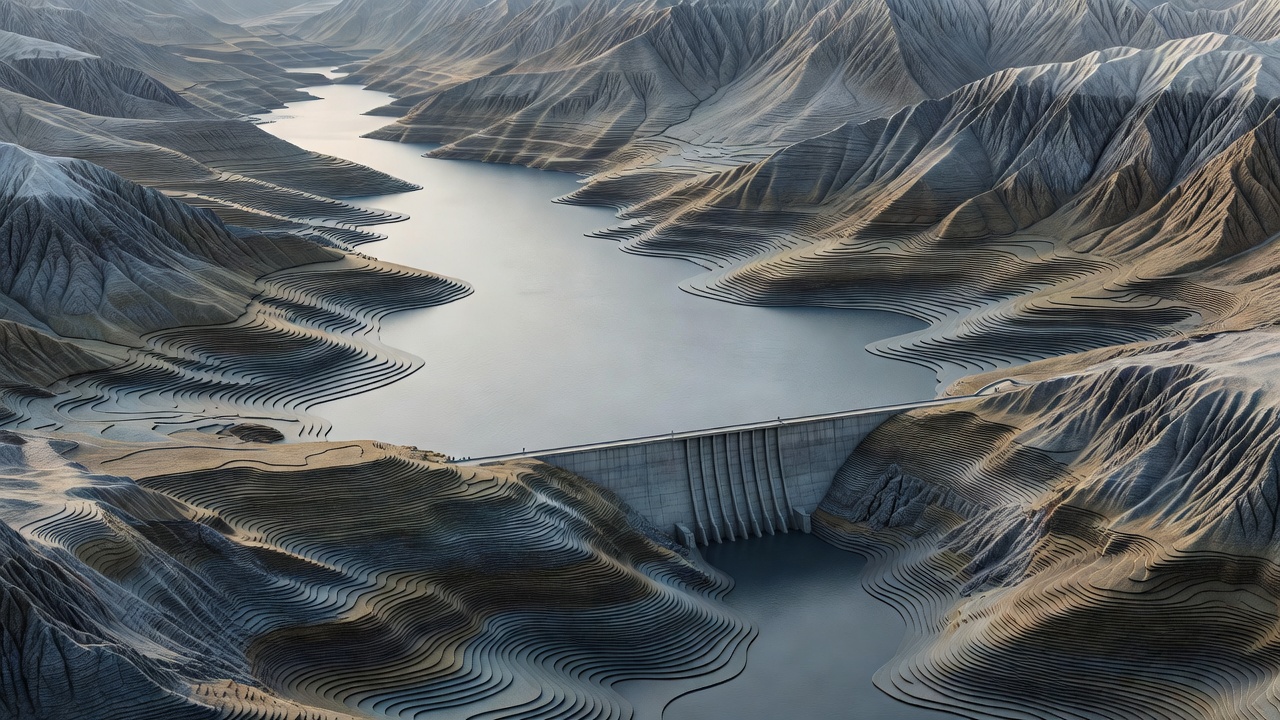
Begin beneath the reflection
From a hotel terrace, a reservoir may seem timeless. Its surface follows the folds of the mountains so convincingly that the flooded valley can disappear from the imagination. Yet the basin may once have contained fields, roads, bridges or settlements. Understanding that earlier geography adds depth to the stay. It also helps explain why a shoreline path suddenly ends, why a village sits above the water, or why a chapel stands on an isolated rise.
Not every reservoir begins in the same way. Some are created by damming a river valley; others result from enlarging an existing lake. The practical distinction matters more than the marketing label. Ask what stores the water, who operates it and which purposes determine the level.
Read the working landscape
Lac de Serre-Ponçon, in the French Alps, is an instructive place to start. Its reservoir landscape belongs to the Durance water system, with electricity generation and wider water management shaping its role. The surrounding mountains and recreational shores do not remove those functions. Lac de Roselend, in the Beaufortain, offers another striking meeting of mountain scenery and hydroelectric infrastructure. Neither place needs to be described as untouched to be compelling.
Farther south, Lac de Sainte-Croix sits within the Verdon landscape. In Switzerland, Lac des Dix presents a more severe high-mountain setting behind the Grande Dixence dam. These are useful geographical references, not a list of luxury hotel recommendations. Accommodation styles, shoreline access and operating conditions differ substantially between them.
The pale band on the shore is not an imperfection in the view. It is evidence that the view is moving.
Understand the drawdown zone
The strip between high and low water is often called the drawdown zone. Depending on geology, slope and operating range, it may appear as mud, stones, rock shelves or a broad, pale terrace. Vegetation cannot always establish itself where inundation changes repeatedly. A photograph taken at high water can therefore describe a very different waterfront from the one a guest encounters later.
For travellers, the consequences are tangible. A floating pontoon may remain usable while the route to it becomes longer. A beach may widen, a cove may become shallow, and a hotel described as waterside may sit noticeably above the active edge. These are reasons to request recent information, not to assume that a lower level automatically makes a destination unsuitable.
Look beyond a single season
Mountain reservoirs respond to combinations of snowmelt, rain, drought, electricity demand, maintenance and other water commitments. There is no universal calendar in which every reservoir is full in summer and low in winter. Individual operating rules matter, and unusual weather can make an ordinary seasonal description unreliable.
Think in scenarios rather than promises. A high-water visit may give a close reflection and short access to a pontoon. A lower-water visit may reveal more of the basin and separate a terrace from the shore. Neither tells you whether the hotel is comfortable, but both influence the meaning of “waterfront.”
| Condition | Possible experience | Check locally |
|---|---|---|
| Higher water | Water closer to established shore facilities | Path closures, currents and permitted access |
| Lower water | Exposed banks and longer routes to the edge | Pontoon access, bank stability and activity locations |
| Rapid change | Temporary restrictions or altered facilities | Operator notices and the property’s current arrangements |
Leave room for the valley’s memory
A reservoir can bring power, water security and recreation while also representing displacement and ecological change. Local museums, interpretation panels and village histories can make those tensions visible. Approach them as part of the destination, rather than as an uncomfortable footnote to the scenery.
When choosing a hotel, notice whether its description acknowledges the surrounding community and working landscape. An informed host should be able to explain the dam’s presence without reducing the valley to a decorative backdrop. A measured account of local history is often more revealing than another adjective attached to the view.
Choose the view with context
The most useful booking question is not simply whether a room faces the reservoir. Ask which direction it faces, what lies between the building and the shore, and how the scene changes with the level. Request a recent photograph if proximity to the water is central to your plans.
Then read the next layer: how buildings sit along the contour. A well-designed terrace, sheltered room and thoughtful walking route can offer a satisfying stay even when the water has withdrawn. Knowing the landscape lets you choose deliberately, rather than asking the reservoir to remain still.